KAPADOKYA (TÜRKIYE)
Welcome to Anatalya and Kapadokya!

Preface
Antalya
Kapadokya
2008.03.26: IC Hotel Airport
2008.03.27: Perge
2008.03.27: Kurşunlu Waterfall
2008.03.27: Antalya
2008.03.28: The road to Cappadocia
2008.03.28: Mevlâna Museum (Konya)
2008.03.28: On the road to again
2008.03.28: Burcu Kaya Hotel
2008.03.29: Walk to Çavusin
2008.03.29: Göreme
2008.03.29: Whirling Dervishes
2008.03.30: Cappadocian House
2008.03.30: Turkish Carpets
2008.03.30: Göreme National Park
2008.03.30: Traditional Turkish folklore
2008.03.31: Caravanserai Sultanhani
2008.03.31: Caravanserai Horozluhan
2008.04.01: Antalya
2008.04.01: Kaleiçi Museum
2008.04.01: Hotel Asteria Sorgun
External links
Preface
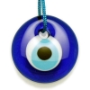
Preface: Just as a preface, let talk about some blue eyes hanging everywhere in Türkiye on houses, in buses, taxis, cars, even on ruins... When visiting countries like Turkey we often across the Evil Eye (Nazar Bocuğu). What exactly is this eye and why is it so evil? How's that? Take an Orthodox from Greece, a Catholic from Mexico or Rome, a Budhist from India or Bangladesh, a Jew from Israel, or a Muslim from Turkey, Iran, or anywhere in the Middle East. Different people, different religions, everybody always fighting all the time, etc, etc. But what do they all have in common? They all believe in the Evil Eye, and they all wear these good luck charms to guard against it...
In Turkey and Balkans, evil eye jewelry and trinkets are particularly common. A nazar or evil eye stone (Turkish: nazar boncuğu) is an amulet from ancient mythology that protects against the evil eye. Colourful beads, bracelets, necklaces, anklets, and all manner of decoration may be adorned by this particularly popular symbol, and it is common to see it on almost anything, from babies, horses, doors to cars, cell phones and even airplanes (see photograph of an airplane with a "nazar"). See more ...
Antalya
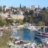
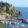
Antalya (Antalya formerly known as Adalia; from Pamphylian Greek: Αττάλεια Attália) is a city on the Mediterranean coast of southwestern Turkey. It is the capital city of Antalya Province. The population of the city is 1,127,634 (2007 census). The city of Antalya corresponds to the lands of ancient Pamphylia to the east and Lycia to the west. Antalya has a hot climate. Situated on a cliff over the Mediterranean, Antalya is surrounded by mountains. Atatürk claimed that without [a] doubt Antalya is the most beautiful place in the world. Developments in tourism and infrasructure (international airport), starting in the 1970s, transformed the city into an international resort. Places to visit in the city include sites with traces of Lycian,Pamphylian, Hellenistic, Roman, Byzantine, Seljuk and Ottoman architecture and cultures. Kaleiçi, with its narrow cobbled streets of historic Turkish and Greek houses is the old center of Antalya, now mainly hotels, gift shops, and bars. New hotels such as the Sheraton are along the coast above the Konyaalti and Lara beaches. The tourism boom has brought migrant labour to the city, fueled the growth of a large construction industry and provided transportation and other large-scale infrastructure which has led to Antalya becoming the hub of commerce in this part of Turkey.In summer tourists include Turkish, British, Israelis, Arabs Germans and Russians. See more ...
Kapadokya
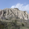
Kapadokya: In ancient geography, Cappadocia or Capadocia, Turkish Kapadokya (from Greek: Καππαδοκία / Kappadokía, which in turn is from the Persian: Katpatuka meaning "the land of beautiful horses"), was the name of an extensive inland district of Asia Minor (modern Turkey). The name continued to be used in western sources and in the Christian tradition throughout history and is still widely used as an international tourism concept to define a region of exceptional natural wonders characterized by fairy chimneys and a unique historical and cultural heritage. The term, as used in tourism, roughly corresponds to present-day Nevşehir Province of Turkey.
It is impossible to define Cappadocia's limits with any real accuracy. In the time of Herodotus, the Cappadocians are supposed to have occupied the whole region from Mount Taurus to the vicinity of the Euxine (Black Sea). Cappadocia, in this sense, was bounded in the south by the chain of Mount Taurus, to the east by the Euphrates, to the north by Pontus, and to the west vaguely by the great salt lake, Lake Tuz, in Central Anatolia. But Strabo, the only ancient author who gives any circumstantial account of the country, greatly exaggerated its dimensions. It is now believed that 400 km (249 mi) east-west by 200 km (124 mi) north-south is a more realistic appraisal of Cappadocia's extension. See more ...
IC Hotel Airport (2008.03.26-27)
After the relative long and bumpy flight with SunExpress Airlines (started at noon in Vienna and takes 2.45 hours) we arrived in Anatlya at the late evening. The visa was given directly in the airport and very unbureaucratic, but we don't understand why austrians and other West-European pays 15 € and hungarians 20 € for a simple postage stamp called "visa". Different EC members eg. old and older? May be this has to do with the summer of 1990 - during the Yugoslavian war - Hungary introduce for the Turkish people a visa and payment of 50$. This can cause the difference of 5 € and for longterm and makes more sense for the Republic during this long years.
Transfer to the IC Hotel Airport Antalya was organized very well, Ali Bay welcomed us with the standard water/cola/beer in the bus and safely drived us to the Hotel after a 45 minute awaiting of other passengers. We expect a bus travel of 30 min. and exactly 2 minutes later we arrive... The travel starts with the waiting of other tourists and was reorganized on the fly. We meet Hüssein, our German and Hungarian speaking guide and everything was clear against all odds.
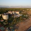
IC Hotels Airport is located only 800 meters from the Antalya International Airport , 5 minutes from Antalya Expo Center , yet less than 15 minutes from Antalya 's beautiful beaches and only few kilometers away from the city - making IC Hotels Airport the perfect spot for business and leisure travel. Its comfortable rooms, expedient location, peaceful surrounding, exclusive personnel and diversified services make IC Airport the ideal choice for short term travelers, tour groups, seminar and conference organization companies, weekend travelers and families. See more ...
Perge (2008.03.27)
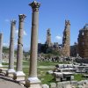
Perge - Originally, a Hellenistic settlement, which later developed into a thriving Roman city, Perge is a historicist’s delight. Situated only 18 km from Antalya in the Pamphylion plain, Perge has a long legacy (almost from 1500 B.C.) to narrate with its initial inhabitants being the Hittites. Its importance also lies in the fact that the ruins of the Roman city provides a very complete picture of the past, thus making it archaeologically invaluable. However, even if you are wondering how an archaeologically fertile site could ever interest you, you should never miss a chance of visiting it. For Perge has much to offer for the vacationer as well, it has a unique blend of the exotic and the ancient. You may have visited many beautiful places, further Turkey itself can boast of a great number of them. But the beauty of Perge lies in its unconventionality, its mysticism and glorious past, and it beckons you to discover it.
Perga, now commonly spelled "Perge" and pronounced "per-geh", was the capital of the then Pamphylia region, which is in modern day Antalya province on the southwestern Mediterranean coast of Turkey. Today it is a large site of ancient ruins 15 km east of Antalya in the coastal plain. Located there is an acropolis dating back to the Bronze Age. In the twelfth century BC, there was a large wave of Greek migration from northern Anatolia (in modern day Turkey) to the Mediterranean coast. Many settled in the area immediately east of the area of modern-day Antalya, which came to be known as Pamphylia, meaning "land of the tribes".
Four great cities eventually rose to promincence in Pamphylia: Perga, Sillyon, Aspendos and Side. Perga itself was founded in around 1000 BC and is nearly 20km inland. It was sited inland as a defensive measure in order to avoid the pirate bands that terrorized this stretch of the Mediterranean. In 546 BC, the Achaemenid Persians defeated the local powers and gained control of the region. Two hundred years later, in 333 BC, the armies of Alexander the Great arrived in Perga during his war of conquest against the Persians. The citizens of Perga sent out guides to lead his army into the city. Alexander's was followed by the diadoch empire of the Seleucids, under whom Perga's most celebrated ancient inhabitant, the mathematician Apollonius (c.262 BC – c.190 BC), lived and worked. Apollonius was a pupil of Archimedes and wrote a series of eight books describing a family of curves known as conic sections, comprising the circle, ellipse, parabola and hyperbola. Roman rule began in 188 BC, and most of the surviving ruins today date from this period.
After the collapse of the Roman Empire, Perga remained inhabited until Selcuk times, before being gradually abandoned. Perga is today an archaeological site and a major tourist attraction. Ancient Perge, one of the chief cities of Pamphylia, was situated between the Rivers Catarrhactes (Duden sou) and Cestrus (Ak sou), 60 stadia from the mouth of the latter; the site is in the modern Turkish village of Murtana on the Suridjik sou, a tributary of the Cestrus, formerly in the Ottoman vilayet of Koniah. Its ruins include a theatre, a palæstra, a temple of Artemis and two churches. The very famous temple of Artemis was located outside the town. Tour guides tell the story that Perga is the birthplace of Beer, allegedly discovered by accident; but recent finds of Pharaonic beer predate the city by far.
Another notable historical figure who twice visited Perga was St. Paul the Apostle and his companion St. Barnabas, as recorded in the biblical book, the Acts of the Apostles (Acts 13:13-14 and 14:25), during their first missionary journey, where they "preached the word" (Acts 14:25) before heading for and sailing from Attalia (modern-day Antalya city), 15 km to the southwest, to Antioch. Perge remains a Roman Catholic titular metropolitan see in the former Roman province of Pamphylia Secunda. Saints Paul and Barnabas came to Perge during their first missionary journey, but probably stayed there only a short time, and do not seem to have preached there (Acts 13:13); it was there that John Mark left St. Paul to return to Jerusalem. On his return from Pisidia St. Paul preached at Perge (Acts 14:24).
The Greek Notitiae episcopatuum mentions the city as metropolis of Pamphylia Secunda until the thirteenth century. Le Quien (Oriens christ., I, 1013) gives 11 bishops: Epidaurus, present at the Council of Ancyra (modern Ankara) in 312; Callicles at the First Council of Nicæa in 325; Berenianus, at Constantinople (426); Epiphanius at the Council of Ephesus (449), at the First Council of Chalcedon (451), and signer of the letter from the bishops of the province to Emperor Leo (458); Hilarianus, at the First Council of Constantinople in 536; Eulogius, at the Second Council of Constantinople in 553; Apergius, condemned as a Monothelite at the Third Council of Constantinople in 680; John, at the Trullan council in 692; Sisinnius Pastillas about 754, and Iconoclast, condemned at the Second Council of Nicæa in 787; Constans, at the same Council of Nicæa (787); John, at the Fourth Council of Constantinople in 869-70. See more ...
Kurşunlu Waterfall (2008.03.27)
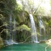
The Kurşunlu Waterfall (Kurşunlu Şelalesi) is located 19 km from Antalya at the end of a 7 km road branching off to the north of the Antalya-Serik-Alanya highway at a point 12 km from Antalya. It is reduced to a mere trickle in the summer months. The waterfall is on one of the tributaries of the Aksu River and its situation in the midst of a pine forest is of quite exceptional beauty. The countryside around the water forms a lovely picnic and pleasure spot only twenty minutes from the centre of the city of Antalya. The Aksu (ancient name in Greek Κεστρoς, Kestros), is a river of Antalya Province (southwestern Turkey), which rises in the mountains of Toros. The course of the Aksu is between the Düden to the west and of the Köprüçay to the east.There are many water resources in Antalya region starting in the high peaks of Tauros Mountains, traveling underground or over the land for many kilometers and finding their ways to the Mediterranean in the end. This is a shot from Kursunlu Waterfall which is 18 km from city center. There is a nice park around the waterfall where you can walk or even have a picnic in pure nature. To name some of the other waterfalls are the Duden Falls 15 km. north of Antalya, Manavgat 3 km. north of Antalya. Last but not least is the Karpuzkaldiran Waterfall at the very hearth of the city in Karpuzkaldiran district. See more ...
Antalya (2008.03.27)
In 150 BC Attalos II, king of Pergamon, founded the city of Attalia (present day Antalya) to base his powerful naval fleet. Later Antalya became part of the Roman Republic in 133 BC when King Attalos III of Pergamum willed his kingdom to Rome at his death and the city grew and prospered in the Ancient Roman period. Christianity started to spread in the region after 2nd century. Antalya was visited by Paul of Tarsus, as recorded in the Acts of the Apostles (Acts 14:25-26), (wherein Antalya is referred to as Attalia). St. Paul and St. Barnabas went to Antalya and sailed from there to Antioch after preaching in Pisidia and Pamphylia. The city later became a naval base for the Christian Crusades against the Muslims in the Levant and in Cyprus. It was a major city in the Byzantine Empire. At the time of the ascension of John II Comnenus (1118) it was an isolated outpost against the Turks, accessible only by sea. The following year, with the aid of his commander-in-chief John Axuch, John II drove the Turks from the land routes to Antalya and recconected the city with the rest of the empire. The city, along with the whole region, was conquered by the Seljuk Turks in the early 13th century. The Arabic traveler Ibn Battuta who came to the city in between 1335-1340 noted.The city of Antalya is situated by the Gulf of Antalya on the Mediterranean coast. The Taurus mountain range of southern Anatolia runs parallel to the Mediterranean in an east-west direction, resulting in the formation of narrow coastal plains, which are surrounded by mountains on three sides and open south to the Mediterranean sea. On some parts of the coast, the mountains plunge sharply into the sea, forming small natural bays and peninsulas. Antalya is situated on a plain which consists of two flat areas formed of falez rock at a height of 35 m, where the mountains recede from the shore. On the first rocky plain on the coast is the town centre and on the plain behind it, named Kepezüstü, small settlement units have been established. In the 1st century BC, the Pergamum king Attalos II ordered his men to find "heaven on earth". After a long search all over the world, they discovered this land and said "This must be 'Heaven' " and King Attalos founded the city giving it the name "Attaleia" (Greek: Αττάλεια) which later became Adalia and then Antalya. Since the area is closed to the cold northerly winds, it is characterized by the typical Mediterranean climate with hot, dry summers and moderately warm and rainy winters. Around 300 days of the year are sunny, the sea temperature never goes below 15°C and in summer is around 29°C. The temperature climbs up to 45°C in July and August. The sea breeze and the northeasterly winds blowing from inland relieve the area under this temperature. See more ...
The road to Cappadocia (2008.03.28)
For millions of years, the mighty volcanoes of the Central Anatolian Plateau erupted and spewed their contents across the land that would become the cradle of civilization. Blessed with a moderate climate and fertile soil, one of the world's earliest known communities was founded 10,000 years ago at Catalhoyuk along the river banks of the Casambasuyu near Konya. Mankind's first nature painting was found here and it portrays the most recent eruption of Hasan Dagi almost 9000 years ago. Today, its snow capped peaks dominate the Konya plain, awash in golden hues where vast wheat fields blend subtly with the ochre colored soil and the monochromatic palette is interrupted only where rivers flow and tall poplars flaunt their greenery.Another great volcano rises in the distance to the east of Hasan Dagi. Once called Mt. Argeus, the awesome presence of Erciyes Dagi inspired legends as the "Abode of the Gods" and the Persians built a Zoroastrian fire temple nearby. These two ancient volcanoes mark the western and eastern boundaries of a region known for its curious volcanic landscape that has been relentlessly carved by nature and by the people who have lived here. 'Fairy chimneys,' cones and strange rock formations have been sculpted by wind and rain while subterranean towns were excavated by a populace seeking shelter from the conquerors and would-be conquerors who crisscrossed the wide open steppes of the Central Anatolian Plateau. Ancient Anatolian tribes, Assyrians, Hittites, Phrygians, Turkic tribes from Central Asia, Mongols, Persians, Syrians, Arabs, Kurds, Armenians, Slavs, Greeks, Romans and Western Europeans have all passed through leaving behind some of their traditions as well as their genes and rendering Cappadocians as exotic as their surreal surroundings.
Cappadocia which is unique in the world and is a miraculous nature wonder is the common name of the field covered by the provinces of Aksaray, Nevsehir, Nigde, Kayseri and Kirsehir in the Middle Anatolian region. In the upper Myosen period in the Cappadocia region as a result of the vulcanic eruptions occurred in Erciyes, Hasandag and Gulludag, in the region was formed a large tableland from the vulcanic tufas and together with the erosion of the Kizilirmak river and wind over ten thausands of years there appeared the chimney rocks which are a wonder of the nature. In the old Bronze Age the Cappadocia which was the population zone of the Assyrian civilization later has hosted the Hittite, Frig, Pers, Byzantine, Seljuk and Ottoman civilizations.
The first Christians escaped from the persecution of the Roman Empire in the 2nd century B.C. came to the Cappadocia over the Antakya and Kayseri and they have settled here. The first Christians finding the underground cities from Cappadocia have been hidden in these underground cities which gates were made in such way in which they couldn't be easily observed and they have escaped from the persecution of the Roman soldiers. Due that they had live in the underground cities for long duration without being able to go out they have developed these underground cities by making provisions rooms, ventilation chimneys, wine production places, churches, abbeys, water wells, toilets and meeting rooms. In the prehistoric periods the first human settlements have begun and the humans have constructed the underground cities in the volcanic rocks in form of tufa due to protect themselves from the wild animals and they lived for long times in these underground cities. Urgup , Cappadocia Turkey Urgup, Cappadocia Turkey In these cities made in form of rooms connected to each others some of the rooms were connected to each other only with the tunnels tight and permitting passing of just a person. At the access gates of these tunnels there were huge stone rollers used for closing the tunnels for security reasons.
The first populations of the region of Cappadocia were Hatties, Luvies and Hittites. In the 3000-2000 years B.C. the Assyrians have established trade colonies in this region. The Cappaddocian tables with cuneiform in Assyrian language founded at Kanes which are lighting the social and politic life of the period and were in the same time the trade and economical agreements are the firs written tablets of Anatolia. According to these documents in that period in Anatolia were founded small local kingdoms non-depending from a central authority. These had in generally in their hands a little area and were living in peace. The region creating the core of the Hittite Empire later has go under the domination of Phrigia and Pers. The Pers civilization has called this region Katpatuka and its center was Mazaka. When Datames the Satrab (Starab: little district administrator at Pers) of Cappadocia has bear arms against the biggest king of Pers, the other Anatolian Satrabs have been supported him but the revolt has been raided. In 33 b.c. the Big Alexander has captured a big part of Cappadocia. In 188 B.C. The Cappadocia which entered under the Roman domination has been captured in 100 B.C. by the Mithridatesd the king of Pontus but in 63 B.C. Pompeius has defeated Mithridates and took again the Cappadocia under the domination of Rome. In the period of Tiberius the Cappadocia gainded the status of Roman district.
Cappadocia was one of the most important places in the spreading periods of the Christian religion. The first christians trying to escape from the Roman soldiers who wanted to avoid the spreading of the Christian religion have settled in the region of Cappadocia which was so suitable for hiding and so they were able to continue their natures and to spread their religions. Saint Basileious from Kaisera and Saint Gregorios from Nyssa had settled in Cappadocia. In 647 A.C. together with occupation of Kayseri by Muaviye Cappadocia has met with the Arabian invasions. Cappadocia which went under the domination of the Seljuks in 1072 has been added to the lands of Ottoman Empire in 1399 by the Ottoman Sultan Yildirim Beyazit. Cappadocia which is in our days one of the most important tourism centers of Turkey is visited every year by hundred thousands of tourists coming from every part of the world. See more ...
Mevlâna Museum / Konya (2008.03.28)
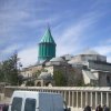
The Mevlâna Museum, located in Konya, Turkey, is the mausoleum of Jalal ad-Din Muhammad Rumi, a Sufi mystic also known as Mevlâna or Rumi. It was also the dervish lodge (tekke) of the Mevlevi order, better known as the whirling dervishes. Sultan Alā' ud-Dīn Key-Qobād, the Seljuk sultan who had invited Mevlâna to Konya, offered his rose garden as a fitting place to bury Baha' ud-Din Walad (also written as Bahaeddin Veled), the father of Mevlâna, when he died on 12 January 1231. Then Mevlâna died in 17 December 1273 he was buried next to his father. Mevlâna's successor Hüsamettin Çelebi decided to build a mausoleum (Kubbe-i-Hadra) over his grave of his master. The Seljuk construction, under architect Behrettin Tebrizli, was finished in 1274. Gurcu Hatun, the wife of the Seljuk Emir Suleyman Pervane, and Emir Alameddin Kayser funded the construction. The original cylindrical construction rested on four pillars with a conical dome , covered with turquoise faience, on top. However several sections were added until 1854. Selimoğlu Abdülvahit decorated the interior and performed the woodcarving of the catafalques.The decree of 6 April 1926 confirmed that the mausoleum and the dervish lodge (Dergah) were to be turned into a museum. The museum opened on 2 March 1927. In 1954 it was renamed as "Mevlâna museum". One enters the museum through the main gate (Devisan Kapısı) to the marble-paved courtyard. The kitchen of the dervishes (Matbah) and the Hurrem Pasha tomb, built during the reign of Süleyman the Magnificent, are located on the right side. On the left side are 17 dervish cells lined up, covered with small domes, and built during the reign of Murad III. The kitchen was also used for educating the dervishes, teaching them the Sema. The ṣadirvan (washing fountain) in the middle of the courtyard was built by Yavuz Sultan Selim. One enters the mausoleum and the small mosque through the Tomb gate (Türbe Kapisi). Its two doors are decorated with Seljuk motifs and a Persian text from mollah Abdurrahman Cami dating from 1492. It leads into the small Tilavet Room (Tilavet Odası) decorated with rare and precious Ottoman calligraphies in the sulus, nesih, and talik styles. In this room the Holy Koran was continuously recited and chanted before the mausoleum was turned into a museum. One enters the mausoleum from the Tilavet Room through a silver door made, according to an inscription on the door, by the son of Sadrazam Sokullu Mehmed Pasha in 1599. On the left side stand six coffins in rows of three of the dervishes (Horasan erler) who accompanied Mevlâna and his family from Belkh. Opposite to them on a raised platform, covered by two domes, stand the cenotaphs belonging to the descendants of the Mevlâna family (wife and children) and some high-ranking members of the Mevlevi order. The sarcophagus of Mevlâna is located under the green dome (Kibab'ulaktab). It is covered with brocade, embroidered in gold with verses from the Koran. This, and all other covers, were a gift of sultan Abdul Hamid II in 1894. The actual burial chamber is located below it.
Next to Mevlâna's sarcophagus are several others, including the sarcophagi of his father Bahaeddin Veled and his son Sultan Veled. The wooden sarcophagus of Mevlâna dates from the 12th century now stands over the grave of his father. It is a masterpiece of Seljuk woodcarving. The silver lattice, separating the sarcophagi from the main section, was built by Ilyas in 1579. A valuable Divan-i-Kebir from 1366 A valuable Divan-i-Kebir from 1366 The Ritual Hall (Semahane) was built under the reign of Süleyman the Magnificent at the same time as the adjoining small mosque. In this hall the dervishes used to perform the Sema, the ritual dance, on the rhythm of musical instruments such as, the kemence (a small violin with three strings), the keman (a larger violin), the halile (a small cymbal), the daire (a kind of tambourine), the kudüm (a drum), the rebab (a guitar) and the flute, played once by Mevlâna himself. All these instruments are on display in this room, together with an ancient Kirşehir praying rug (18th c.), dervish clothes (Mevlâna's included) and four crystal mosque lamps (16th c., Egyptian Mameluk period). In this room one can also see a rare Divan-i-Kebir (a collection of lyric poetry) from 1366 and two fine specimens of Masnavis (books of poems written by Mevlâna) from 1278 and 1371. The adjoining small mosque (Masjid) is now used for the exhibition of a collection of old, illustrated korans and extremely valuable prayer rugs. There is also a box (Sakal-i Ṣerif), decorated with nacre, containing the Holy Beard of Muhammad. See more ...
On the road again (2008.03.28)
Cappadocia lies in central Anatolia, in the heartland of what is now Turkey. The name, traditionally used in Christian sources throughout history,[citation needed] continues in use as an international tourism concept to define a region of exceptional natural wonders, in particular characterized by fairy chimneys and a unique historical and cultural heritage.The relief consists of a high plateau over 1000 m in altitude that is pierced by volcanic peaks, with Mount Erciyes (ancient Argaeus) near Kayseri (ancient Caesarea) being the tallest at 3916 m. The boundaries of historical Cappadocia are vague, particularly towards the west. To the south, the Taurus Mountains form the boundary with Cilicia and separate Cappadocia from the Mediterranean Sea. To the west, Cappadocia is bounded by the historical regions of Lycaonia to the southwest, and Galatia to the northwest.
The Black Sea coastal ranges separate Cappadocia from Pontus and the Black Sea, while to the east Cappadocia is bounded by the upper Euphrates, before that river bends to the southeast to flow into Mesopotamia, and the Armenian Highland. This results in an area approximately 400 km east–west and 250 km north–south. Due to its inland location and high altitude, Cappadocia has a markedly continental climate, with hot dry summers and cold snowy winters. Rainfall is sparse and the region is largely semi-arid. See more ...
Burcu Kaya Hotel (2008.03.28)
Welcome to Burcu Kaya Hotel in Capadocia, where history, geography and culture uniquely meet. (You will feel at home at Burcu Kaya Hotel). Time at Burcu Kaya hotel transform to fascinated and comfortable adventure between past and today. Burcu Kaya hotel prepared with care twenty years ago for wish host you. We are honor to share our twenty years with reliable, friendly and professional staff with you.We are ready to host your visit as you explore in Capadocia, which is calm and fascinated.Our Hotel is located in Ortahisar, the center of Cappadocia where the history and culture meet in a world of mystery. The hotel building was modeled on ancient Seljuk architecture and carved into rocks. With diligently decorated 82 rooms and 164 beds Burcu Kaya Hotel has been serving her visitors for 20 years to make their holiday nice and unforgettable. You also have a chance to spend a great time in our diligently decorated lobby with a fireplace or our bar, or to taste our delicious cultural foods, which are prepared with naturally produced vegetables and fruits from ecological agriculture fields. While you are enjoying the swimming pool with view of fairy chimneys, you can hold your business meetings in our technically well-equipped meeting room. The professional and experienced personnel of our hotel will treat you with respect as the traditional Turkish hospitality, and will wish you have one of your best memories in Cappadocia. See more ...
Walk to Çavusin (2008.03.29)
Çavusin is situated 2 km from Göreme, on the Göreme - Avanos road. The Church of St. John the Baptist offers a panoramic view of the village. This church and its paintings date back to the 5th century, making it the oldest church in the region. It had a large courtyard, which is unusual for Cappadocia; this has been eroded away however.Christian missionaries and communities once lived in the old Çavusin valley, now in ruins. There are 5 churches at Güllüdere, close to Çavusin. The Hacli Church (with the Cross), near the valley, was also used for defense against the Arab raiders. See more ...
Göreme (2008.03.29)
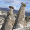
Göreme (Greek: Κόραμα "Korama"), located among the "fairy chimneys" rock formations, is a town in Cappadocia, a historical region of Turkey. It is in the Nevşehir Province in Central Anatolia. The Göreme National Park (Göreme Milli Parklar in Turkish) was added to the UNESCO World Heritage List in 1985. The first period of settlement within the region reaches to Roman period of Christianity era. Among historical sites are Ortahane, Durmus Kadir, Yusuf Koc and Bezirhane churches in Göreme, including Tokali Kilise, the Apple Church, houses and shafts engraved from rocks.After the eruption of Mount Erciyes about 2000 years ago, the lava formed soft rocks in the Cappadocia Region, covering a region of about 20,000 km2. The softer rock was eroded away by wind and water, leaving the hard cap rock on top of pillars, forming the present-day fairy chimneys. People of Göreme, at the heart of the Cappadocia Region, realized that these soft rocks could be easily carved out to form houses, churches, monasteries. These Christian sanctuaries contain many examples of Byzantine art from the post-iconoclastic period. These frescoes are a unique artistic achievement from this period. In the 4th century small anchorite communities began to form in the region, acting on instruction of Saint Basil of Caesarea. They carved cells in the soft rock. During the iconoclastic period (725-842) the decoration of the many sanctuaries in the region was held to a minimum, usually symbols such the depiction of the cross. After this period, new churches were dug into the rocks and they were richly decorated with colourful frescoes.
Tokalı Kilise (or the Church of the Buckle), is the largest church in Göreme. Restoration of the church was completed during the 1980s. One noted feature of the church is the main nave containing ninth century frescoes in "provincial" style, the more recent additions are three apses of the 11th century frescoes, which are rendered in "metropolitan" style. The church contains frescoes of the twelve apostles, the saints and scenes from the life of Jesus (963-969 and 11th century respectively). The church also has a crypt underneath the nave.
The Buckle Church is formed of four chambers: the Old Church, the larger New Church, the Paracclesion, and the Lower Church. The Old Church dates to the 10th century. It was originally a single-naved barrel-vaulted church. But its apse was destroyed when the New Church was added at the end of the 10th or early 11th century. Now the Old Church provides entrance to the New Church. The Old Church is decorated with pale hues of red and green painted in strips to represent scenes from the New Testament and depictions of some saints. Panels of rich indigo painted with pigments from the lapis lazuli stone dominate the New Church : scenes from the New Testament, miracles of Christ, the first deacons, episodes from the life of St. Basil (one of the Cappadocian Fathers), depictions of Leades (one of the Forty Martyrs) and St. Menas.
The New Church was carved out of the eastern wall of the Old Church and decorated with Eastern-style arches and a series of arcades. The Paracclesion, located at the left side of the New Church, is a barrel-vaulted chapel with a single apse. The Lower Church has three aisles and a burial space or krypto. Elmalı Kilise (or the Apple Church) a smaller cave church. Was built around 1050AD and has carved into four irregular pillars the sign of a Greek cross with these pillars support it's central dome. Restoration on the church was completed in 1991, but the frescoes continue to chip off, revealing a layer of earlier paintings underneath. The church's paintings depict scenes of the saints, bishops, and martyrs. and to the right of the altar, a Last Supper with the symbolic fish (the letters of the word fish in Greek, ΙΧΘΥΣ, stand for "Jesus Christ, Son of God, the Savior"). The name of the church is believed to refer to a reddish orb in the left hand of the Archangel Michael in the dome of the main apse, or possibly to an apple tree that grew in the vicinity.
Barbara Kilise, (or the Church of Saint Barbara) Barbara was an Egyptian saint who was imprisoned by her father in order to protect her from the influences of Christianity. Barbara nevertheless found a way to practice her faith and her father tortured and killed her. Built in the late Eleventh Century A.D, the church was possibly built as a tribute to the Martyr-Saint. The church has the same layout as Çarikli Kilise. The church has a cross-dome with one central apse, two side apses and two columns. The dome depicts Christ on the Throne. with geometrical patterns painted in red ochre, painted directly on the rock, believed to be symbolic in nature. Another fresco with the large locust possibly representing evil, which is warded off by the protection of two adjacent crosses. The north wall of the church contains a fresco of St. George and St Theodore on horse-back struggling against the dragon and snake. The monks drew red ochre lines on the rocks, to give the impression that cut stones were used in the construction. Yilanlı Kilise(or the Snake Church) is a simple barrel-vaulted church with a low ceiling and long nave. It is name for the frescoe of Saints Theodore and St George slaying the dragon (or snake as depicted in the frescoe). The church also has a frescoe of Emperor Constantine and his mother Saint Helena depicted holding the "True Cross." Legend has it that she discovered the cross upon which Jesus was crucified after seeing it in a dream, and that a piece of the cross is still buried in the foundations of the Hagia Sophia in Istanbul.
Other sections of the cross are in the Church of the Holy Sepulchre and in St. Peter's in Rome. Another interesting portrait is the one of Saint Onuphrius on the upper wall to the right of the entrance. The saint, lived the life of a hermit in the Egyptian desert near Thebes, Egypt and is usually depicted with a long gray beard wearing only a fig leaf. Karanlık Kilise (or the Dark Church) was a monastic compound built in the 11th century. It is a domed church with one main apse, two small apses and four columns. It was decorated with scenes from the New Testament: Christ Pantocrator, Nativity, Adoration of the Magi, First Bath, Last Supper, Betrayal of Judas, Crucifixion, Anastasis. After the Turkish invasion it was used as a pigeon house until 1950s. After 14 years of scraping pigeon droppings off the walls, these newly restored frescoes, depicting scenes from the New Testament, are the best preserved in all of Cappadocia and a fine example of 11th-century Byzantine art. Part of the narthex or vestibule however collapsed opening part of the church's roof to the sky. This caused damage to the fresco with Christ’s Ascension and the Benediction of the Saints, whereas the other scenes are only partially remain where the wall collapsed. The church's name possibly comes from a small oculus looking out of the narthex which only lets in a very small amount of light. This feature is what has preserved the richness of the pigments and allowed them survived the test of time.
Çarıklı Kilise (the Church with Sandals) the name comes from the two footprints at the bottom of the Ascension fresco at the church's entrance (this fresco is said to be an exact copy of the one contained at the Church of the Ascension in Jerusalem). The church is cut into the same rock as Karanlik Kilise. The footprints themselves, have many unconfirmable legends attached to them. The church is carved into a cross floor plan with intersecting vaults. The church's frescoes, which date to the 11th century, contain the four Evangelists, the Nativity and the Crucifixion, the Baptism, the Adoration of the Magi, and other New Testament themes. See more ...
Whirling Dervishes (2008.03.29)
The Mevleviye, one of the most well known of the Sufi orders, was founded in 1273 by Rumi's followers after his death, particularly by his successor Hüsamettin Çelebi who decided to build a mausoleum for Mevlâna, and then Mevlâna's son, Sultan Veled Celebi (or Çelebi, Chelebi) (the word "Çelebi" means " fully initiated"). He was an accomplished Sufi mystic with great organizing talents. His personal efforts were continued by his successor Ulu Arif Çelebi. The Mevlevi, or "The Whirling Dervishes", believe in performing their dhikr in the form of a "dance" and music ceremony called the sema.The Sema represents a mystical journey of man's spiritual ascent through mind and love to "Perfect." Turning towards the truth, the follower grows through love, deserts his ego, finds the truth and arrives at the "Perfect." He then returns from this spiritual journey as a man who has reached maturity and a greater perfection, so as to love and to be of service to the whole of creation.
The Mevlevi Order or the Mevleviye are a Sufi order founded by the followers of Jalal ad-Din Muhammad Rumi, a 13th century Persian (Tādjīk) poet, Islamic jurist, and theologian, in Konya (in present-day Turkey). They are also known as the Whirling Dervishes due to their famous practice of whirling as a form of dhikr (remembrance of Allah). Dervish is a common term for an initiate of the Sufi Path. The Mevleviye, one of the most well known of the Sufi orders, was founded in 1273 by Rumi's followers after his death, particularly by his successor Hüsamettin Çelebi who decided to build a mausoleum for Mevlâna, and then Mevlâna's son, Sultan Veled Celebi (or Çelebi, Chelebi) (the word "Çelebi" means " fully initiated"). He was an accomplished Sufi mystic with great organizing talents. His personal efforts were continued by his successor Ulu Arif Çelebi.
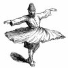
The Mevlevi, or "The Whirling Dervishes", believe in performing their dhikr in the form of a "dance" and music ceremony called the sema. The Sema represents a mystical journey of man's spiritual ascent through mind and love to "Perfect." Turning towards the truth, the follower grows through love, deserts his ego, finds the truth and arrives at the "Perfect." He then returns from this spiritual journey as a man who has reached maturity and a greater perfection, so as to love and to be of service to the whole of creation. The sema was practised in the semahane (ritual hall) according to a precisely prescribed symbolic ritual with the dervished whirling in a circle around their sheikh, who is the only one circling around his axis. The dervishes wear a white gown (symbol of death), a wide black cloak (hirka) (symbol of the grave) and a high brown cap (kûlah), symbol of the tombstone. The Mevlevi became a well-established Sufi order in the Ottoman Empire by realizing a blood relationship with the Ottoman sultans when Devlet Hatun, a descendant of Sultan Veled, married the sultan Bayezid I. Their son Mehmed I Çelebi became the next sultan, endowing the order, as did his successors, with many gifts. Many of the members of the order served in various official positions of the Caliphate. The centre for the Mevlevi order was in Konya, where their 13th century guiding spirit, Mevlana (Jelaleddin al-Rumi) is buried.
There is also a Mevlevi monastery or dergah in Istanbul, near the Galata Tower, where the sema (whirling ceremony) is performed and accessible to the public. During the Ottoman Empire era, the Mevlevi order produced a number of famous poets and musicians such as Sheikh Ghalib, Ismail Ankaravi (both buried at the Galata Mevlevi-Hane) and Abdullah Sari). Vocal and instrumental music, especially the ney, plays an important role in the Mevlevi ceremony and famous composers such as Dede Efendi wrote music for the ayin (cycle of Mevlevi ceremonial music). The ayin text is normally a selection from the poetry of Mevlana. If one buys a CD of Turkish Sufi music, chances are it will be a Mevlevi ayin. During the Ottoman period, the Mevlevi order spread into the Balkans, Syria, and Egypt (and is still practiced in both countries where they are known as the Mawlawi order). The Bosnian writer Meša Selimović wrote the book "The Dervish and Death" about a Mevlevi dergah in Sarajevo. The Mevlevi Order has some similarities to other Dervish orders such as the Qadiri (founded in 1165), the Rifa'i (founded in 1182), and the Kalenderis.
The Mevlevi Order was outlawed in Turkey at the dawn of the secular revolution and the dervish lodge was converted to Mevlana Museum in Konya by Kemal Atatürk. In the 1950s, the Turkish government legalized the Mevlevi order as an association and began allowing the Whirling Dervishes, who are chosen among the members of this authentic Mevlevi sect, to perform annually in Konya on the Urs of Mevlana, December 17, the anniversary of Rumi's death. In 1971, they performed in London with Kani Karaca as lead singer. In 1972, they toured North America for the first time with Kani Karaca, Ulvi Erguner, and Akagündüz Kutbay among the musicians. They performed in France, for Pope Paul VI, and at the Brooklyn Academy of Music and other venues in the United States and Canada - under the direction of the late Mevlevi Shaikh Suleyman Hayati Dede. In April of 2007 the order initiated another tour of the U.S. where they performed to sold-out crowds, in places such as Denver and San Francisco. The order is still active in Turkey, currently led by the 20th great-grandson (22nd generation descendant) of Rumî, Faruk Hemdem Çelebi. See more ...
Cappadocian House (2008.03.30)
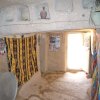
Traditional Cappadocian houses and dovecotes carved into stones are showing the uniqueness of the region. These houses are constructed on the feet of the mountain via rocks or cut stones. Rock, which is the only construction material of the region, as it is very soft after quarry due to the structure of the region, can be easily processed but after contact with air it hardens and turns into a very strong construction material. Due to being plentiful and easy to process of the used material, regional unique masonry is developed and turned into an architectural tradition. Materials of neither courtyard nor house doors is wood. Upper parts of the doors built with arches are decorated with stylized ivy or rosette motifs.Dovecotes within the region are small structures constructed within 18th century and end of 19th century. Some of the dovecotes, which are important for showing Islamic picture art are constructed as monastery or church. Surfaces of dovecotes are decorated with rich inscriptions and adornments by regional artists. See more ...
Turkish Carpets (2008.03.30)
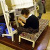
Turkish carpets come in distinct styles, from different regions of Turkey. Important differentiators between the types include the materials, construction and the patterns. Wool on Wool (wool pile and wool warps and wefts): This is generally the least expensive type of carpet, but often the most "authentic" if such a word can be used. Wool on wool carpets have been made much longer and use more traditional designs than the other types of carpets. Because wool cannot be spun finely, the knot count is often not very high, compared to wool on cotton and silk on silk. High knot count is also not necessary for wool on wool carpets because they are often traditional geometric designs, or otherwise non-intricate patterns. Wool on cotton (wool pile on cotton warps and wefts): This type of carpet can be much more intricate than wool on wool carpets because cotton can be spun finely and the knot count is generally much higher. In wool on cotton rugs, floral designs etc. are also found, in addition to the geometric patterns. Silk on Silk (silk pile on silk warps and wefts): This is the most intricate type of carpet with very fine weave. Knot count for silk carpets intended for floor coverings should be no greater than 100 knots per square cm, or 10 X 10 cm² and can be as fine as 28 X 28 knots/cm². Any carpet woven with the knot count greater than 10 X 10 knots/cm² should only be used as a wall or pillow tapestry. These very fine, intricately woven carpets are no larger than 3m X 3m and are stunningly beautiful.Carpets, whether knotted or flat woven (kilim) are among the best known art forms produced by the Turks from time immemorial. There are environmental, sociological, economic, and religious reasons for the widespread art of carpet weaving among the Turkish people from Central Asia to Turkey. The geographical regions where Turks have lived throughout the centuries lie in the temperate zone. Temperature fluctuations between day and night, summer and winter may vary greatly. Turks-nomadicor pastoral, agrarian or town-dwellers, living in tents or in sumptuous houses in large cities-have protected themselves from the extremes of the cold weather by covering the floors, and sometimes walls and doorways, with carpets. The carpets are always hand made of wool or sometimes cotton, with occasional additions of silk. These carpets are natural barriers against the cold. The flat woven kilims which are frequently embroidered are used as blankets, curtains, and covers over sofas or as cushion covers.
In general, Turks take their shoes off upon entering a house. Thus, the dust and dirt of the outdoors are not tracked inside.The floor coverings remain clean, and the inhabitants of the house, if need be, can comfortably rest on the floor. In the traditional households, women and girls take up carpet and kilim weaving as a hobby as well as a means of earning money. Even technological advances which promoted factory-made carpets could not hamper the production of rug weaving at cottage-industry level. Although synthetic dyes have been in use for the last 150 years, hand made carpets are still considered far superior to industrial carpeting. Turkish carpets are among the most sought after household items all over the world. Their rich colors, warm tones, and extraordinary patterns with traditional motifs have contributed to the status that Turkish carpets have maintained since the 13th century. Marco Polo, who traveled through Anatolia in the late 13th century, commented on the beauty and artistry of the carpets. A number of carpets from this period, known as the Seljuk carpets, were discovered in several mosques in central Anatolia. These were under many layers of subsequently placed carpets.
The Seljuk carpets are today in the museums in Konya and Istanbul. It is very exciting to imagine that we may be looking at the very same carpets that Marco Polo praised in the year 1272. Turkish carpets in the 15th and 16th centuries are best known through European paintings. For example, in the works of Lotto (15th century Italian painter) and Holbein (16th century Germanpainter), Turkish carpets are seen under the feet of the Virgin Mary, or in secular paintings, on tables. In the 17th century, when the Netherlands became a powerful mercantile country, Turkish carpets graced many Dutch homes. The Dutch painter Vermeer represented Turkish carpets predominantly to indicate the high economic and social status of the persons in his paintings. Turkey carpets, as they were known, were too valuable to be put on floors, except under the feet of the Holy Mother and royalty. Anyone who enters a mosque has to take off his/her shoes. The mosque is the common house of a Muslim community, therefore, shoes are cast off before the door. Moreover, the ritual of prayer requires the faithful to kneel and touch the ground with one s forehead in humility before God. There are no chairs or benches in a mosque, only carpets. A Turkish mosque is often covered from wall to wall with several layers of carpets. The Turkish carpets have exuberant colors, motifs, and patterns. No two carpets are the same; each one is a creation from a new. Because traditionally women have woven the carpets, this is one art form that is rarely appreciated as being the work of a known or a specific artist. Nevertheless, the Turkish women silently continue to create some of the most stunning examples of works of art to be distributed all over Turkey and the world. See more ...
Göreme National Park (2008.03.30)
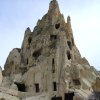
Göreme National Park has the most interesting and beautiful land formations in Turkey and is worth seeing. Hasan Mountain and Erciyes Mountain, the two largest inactive volcanoes in Central Anatolia, were active in earlier geological periods and the whole region was covered with tufa spewed from the volcano. The fantastic Göreme National Park, which was created by nature as the result of erosion from wind and rain over centuries, has formed the countless fairy chimneys, caves and beautiful rock formations, and the colors that used to be red, pink and brown were transformed in time into gray, yellow and green. Göreme National Park, which was an official state during the period of the Roman Empire, was named "Capadocia", which means "the Country of White Horses" in Persian. The region shelters a unique land structure and was used intensively as a religious center by the early Christians during the Roman and Byzantine Periods. The volcanic, soft tufa structures were carved easily by the early Christians and underground cities, monasteries and churches were built. Uchisar, with its panoramic view and citadel; Göreme, with its frescoed churches in Open Air Museum, pensions, hotels, restaurants and cafes; Zelve, with its monastery complexes; Avanos, with its workshops, which produce pottery and extraordinarily beautiful glazed tiles; Urgup, a center for shopping and spending the night; Kaymakli and Derinkuyu with their underground cities, are all worth seeing. Nevsehir Province is at the center of the volcanic plateau, Kirsehir Province is to the north, Kayseri Province is to the east, Nigde Province is to the south and Aksaray Province is to the west.The Göreme National Park and the Rock Sites of Cappodocia are located in Turkey (38°26'N, 34°54'E) and is a World Heritage Site, with the the park boundaries extending south-west directly to the peak of Pinarcik Tepe (Kayacik Dag) and Kermil Dagi, thence eastwards to Ibrahimpasa, Ortahisar and back to Ürgüp. In Nevsehir Province of Central Anatolia, between Nevsehir city and the towns of Avanos and Urgüp. The park circumference is approximately 40 kilometers (km), extending from the bridge at Ürgüp then leading north for 6 km following the River Damsa. The boundary then heads west, immediately to the north of Zelve and south of the River Kizilirmak, by Avanos to Toprak Tepe. Established on 25 November 1986 as a historical national park under the Law of National Parks No. 2873, following proposals and draft management plans drawn up by the General Directorate of Forestry and National Parks in 1968. Protection for Göreme Valley and its surroundings was established in Decree No. A-69 of the High Council of Monuments and Historic Sites promulgated on 10 July 1976 in the "Cappadocia General Conservation Plan". This required the preparation of detailed development plans. The protection of the site is further assured under the Cultural and Natural Assets Act 2863 enacted on 23 July 1983. The site was inscribed on the World Heritage List in 1985. See more ...
Trad. Turkish folklore (2008.03.30)
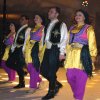
In the evening we visit an underground restaurant for a traditional Turkish folklore show, with dances and costumes from several regions rich in folklore, including Gaziantep, the Mediterranean, and the Black Sea. The mysterious and alluring art of belly-dancing, and an enjoyable evening of traditional Turkish dance.The most interesting was the wedding ceremony which was an elaborate and drawn out affair but ended in about three hundred of us doing a conga around a fire outside. There was lots of crowd participation and it was all good fun.
The last act of the night was the belly dancer who descended from the roof in a cage that made it feel like we were at a strip club. Not that I would know what that is like. She jiggled and jangled around the stage and then selected someone from the audience to accompany her in her routine... See more ...
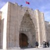
Caravanserai Sultanhani (2008.03.31)
A door left ajar beckons... "Come in & experience the magic of the past...." A caravanserai is an old hotel that served traders and travellers along the Silk Route. It provided protection against the elements and robbers, hence the external walls are quite high and thick, like a fortress. There are many of these along the silk route - about one every 17 miles because camels could only walk about that far in a day. Despite the ornate entrance, the interior of the caravanserai is essentially quite basic, but the simplicity of the building is in itself quite beautiful, with high ceilings and geometric lines.The Caravanserai at Sultanhani on the road to Aksaray or caravansary (to use the English term) was built in the 13th century and provided free lodging, stables and food to merchants heading along the Silk Road. As a result of this, commerce flourished under the Seljuk rule. Today, there are no camels in the stable or traders selling their wares, just one man with a hose to tend to the few plants inside, and a prayer mat in the small arched tower that sits in the middle of the courtyard.
The caravansary is very well preserved, and it's not difficult to imagine how the sight of this would have been a welcome one to weary travellers - well, we had the very same experience! It must have been quite a place when the traders were in town and the impromptu markets were buzzing with people, selling their wares.
Final leg - and a giraffe-sized leg it was too. Plenty of opportunity to witness first hand just how strong the Turkish belief in Kismet (luck) and Kadur (fate) is. We saw numerous drivers put their faith in Allah as they overtook other vehicles on blind bends. The trouble is the truck drivers also have faith - so much so that almost all trucks in Turkey have the phrase 'Masallah' on the front. And I think I know whose luck would be in, and who would be fated to come worse off in the event of a collision. See more ...
Caravanserai Horozluhan (2008.03.31)
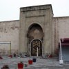
Right at the entrance to Konya from Ankara on the highway is the Caravanserai Horozluhan located, around 4-5 km from Konya away. The caravanserai is quite unnoticible because of the high buildings around it. It is almost near the giant wheat deppot (TMO Silo). Run as a restaurant for quite a long time and nice place and setting for tasting local Konya delicasies such as etli ekmek (Turkish pizza with minced meat), çömlekte kuru fasulye (dry beans cooked in clay pots), ezo gelin çorba (lentil soup with various herbs) etc.It was just an unusual dinner, but it was very nice and had a fleur and touch of Turkey. See more ...
Antalya (2008.04.01)
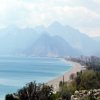
Antalya (population 2 million), "capital" of the Turkish Mediterranean Coast, is a sprawling modern city with a small, charming historic center, a good archeology museum, long sunny beaches to east and west, the Turquoise Coast's busiest airport, good hotels, lots to see and do, and dramatic sea and mountain views. The historic center, called Kaleiçi (KAH-leh-ee-chee, or Old Antalya) surrounds the Roman harbor. Many buildings here date from Ottoman times, a few from Roman times, and some have been restored as houses, boutique hotels and inns, pensions or restaurants. Antalya's prime beach is Konyaalti Plaji, a l-o-n-g swath of rough sand and pebbles running west for several kilometers. The sand is somewhat softer along Lara Plaji to the east. Other beaches are farther afield at Side and Alanya to the east, or Kemer, Phaselis and Olimpos to the south. Visit Antalya for Kaleiçi, the museum and beaches, and because it's the transportation hub of the region with a big, modern airport 10 km (6 miles) east of the city center, and a big, modern bus terminal (Otogar) 4 km (2.5 miles) north. Here's more on how to get to Antalya, and how to get around. See more ...Kaleiçi Museum (2008.04.01)
"…Adalya Castle is built in an arc at the end of a bay and set on a rock as high as a minaret. The distance around the city is 4400 steps. From the west, from the corner of the Paşa Castle to the Narin Tower and passing through the suburb door to Mehterhane Tower, as far as the Lala Tower in the east, are two double walls. Altogether there are 80 towers. The castle has 4 big doors, one of these being the door to the outskirts. The other 3 lead to the marina. Apart from these 4 doors there are 22 other doors within the district. Within the castle there are 4 main areas with 1000 closely built houses. The roads are paved. In the city there are 8 Turkish Baths and many of these are inside Kaleici. There is a covered market on the outskirts. Here there are 20 Muslim districts and 4 Greek districts, but the non Muslims do not speak Greek. The marina can hold 200 boats, but there is always winds and storms and for this reason the boats are always moored to the higher rocks. The oranges, dates, olives, figs, sugar canes and pomegranates of this area are of world renown. On every side there are vineyards and gardens. The most famous being the Tekeli Paşa Garden. The people speak perfect Turkish just as the Anatolians, are well educated, polite and friends of the lonely…" Evliya Çelebi 17th Century Ottoman Explorer (1671 Antalya)The Suna&Inan Kiraç Research Institute on Mediterranean Civilizations, within the Vehbi Koç Foundation, is an international establishment chartered to serve the word of history, culture, and art; to encourage and support researches to investigate, document, protect, and restore the historical, archaeological, ethnographical and cultural values of Antalya and its surrounding; and to elucidate the region's deep-rooted relations with the Mediterranean region. It is also among the Institute's goals to contribute to the domains of culture and art as an organization intent on supporting such correlated activities and exhibitions. The Institute was inaugurated on 18th May 1996 after restorations carried out on two buildings acquired on a parcel by Suna&Inan Kiraç the Old City of Antalya, an area under protection as an "Important Archaeological and Cultural Site". Later in 1999, it became a larger complex through the restoration of an adjacent old mansion of historical value. Today, the Institute complex consists of three independent buildings, all very picturesque to behold. The first one used by the Center is a late example of a traditional two-story Turkish house in "L" form with an exterior anteroom. Then almost all in ruins, it was reconstructed according to the prerequisites of contemporary architecture for libraries and finished in a style harmonious with the traditional architecture of the Old City. The upper story of the house now holds Reading Rooms with a Rare Books and Periodicals Section and a small Conference Room; the ground level consists of the Main Library, the Administrative Office and a Recreational Courtyard. The Institute's collection of rare books: library of works on Antiquity with emphasis on the specific geography of the region; archives of documents, photographs and transparencies are accessible for the use of resident and the guest researchers and scholars. The Suna&Inan Kiraç Research Institute on Mediterranean Civilizations, is also fulfilling an important function with its specialized publications, in addition to such annually scheduled activities as conferences, symposiums, seminars, showing of archaeological films, exhibits and concerts. See more ...
Hotel Asteria Sorgun (2008.04.01)
The hotel is located on the shores of the Blue Mediterranean at Sorgun's long and wide sandy beach. Using the modern architecture style 5 floors main building.The Hotel is a classical wild tourism place, very interesting is for a five star Hotel, that the soap was missing at the first day and the used shower gel was replaced after intervention on the desk.
Lot of one-time-turkey-visitors from Germany and from other places, if you see them ever, you know what I mean. Noise, chaos, crowd, everything what wanna leave home and will not have during your vacation.
I was happy to leave the Hotel after this trip. See more ...
Some links about the visited places:
www.antalya.gov.tr
www.aboutantalya.net
www.antalya-ws.com
www.kultur.gov.tr
www.cappadociaturkey.net
www.cappadociaonline.com
www.cappadociatours.com
whc.unesco.org
www.nazarboncugu.com
www.goremehouse.com
www.kaleicimuzesi.com
www.ichotels.com.tr
www.asteriahotels.com
www.kursunluselalesi.com
www.360tr.com
www.burcukayaotel.com.tr
www.horozluhan.com
